This 3.2 m (10.5ft) tall stone was excavated in 1871, and a beach pebble found as a foundation offering. It collapsed in 2003 and was subsequently re-erected by the Historic Environment Service.
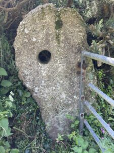
This 3.2 m (10.5ft) tall stone was excavated in 1871, and a beach pebble found as a foundation offering. It collapsed in 2003 and was subsequently re-erected by the Historic Environment Service.
This standing stone is visible from the Merry Maidens stone circle. It stands in a hedge near to the corner of the field that lies to the NW of the B3315 road.
A public footpath crosses the field in a diagonal direction from the corner opposite to the small parking area at the bottom of the Merry Maidens field.
It was found to be standing in very shallow soil, so may have been moved to the hedge from the field at some point in the past. However there is a direct alignment (which may have been a processional path) from this stone to the Merry Maidens, through the entrance gap, on to a standing stone in a hedge, through the site of a lost stone circle (Trenuggo) and ending at a farm called Borah, whose name proba- bly means ‘the place of the witch’. This may be a very ancient ritual pathway or significant ceremonial alignment.


The site dates from the late Neolithic-early Bronze Age (approx. 2500-1500 BC) and consists of a circle of 19 stones, standing slightly below a ridge
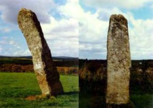
The NE Piper is Cornwall’s tallest standing stone at 4.6 m (15ft), and the SW Piper is the second tallest at 4.1 m (131⁄2ft). Standing stones (of which
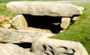
Entrance Graves (or Chambered Tombs as they are sometimes known) date from them Neolithic period (approx 3000-2500 BC), so it was probably constructed before the stone circle.